Geophysical Instrument
-
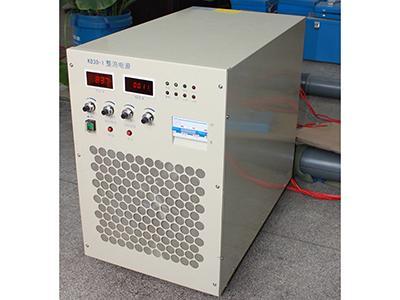
- Electromagnetic Method Instrument, Type CLEM-V The electromagnetic method instrument is composed by a KD30-1 rectifier, a CLEM-T30 high power electromagnetic method transmitter, a CLEM-R5 array electromagnetic method receiver, magnetic sensor and processing software etc.
-
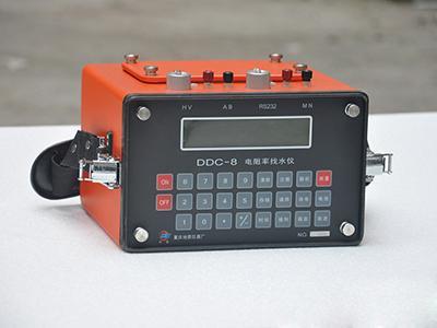
- Electrical Resistivity Measuring Instrument, Type DDC-8 Electrical resistivity measuring instrument, Type DDC-8 uses apparent resistivity and can directly demonstrate the measured values, e.g. resistivity (Rs), average current (I) and average voltage (V). Electrical resistivity measuring instruments can be used in hydrology, environment protection, engineering geophysics ...
-
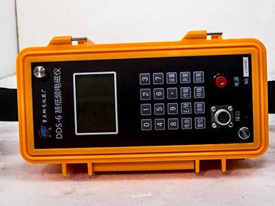
- Low Frequency Electromagnetic Meter, Type DDS-6 DDS-6 low frequency electromagnetic meter is a small and light instrument used to measure multiple parameters of very low frequency electromagnetic fields. It can also quickly perform resistivity mapping, and locate underground pipelines and cables.
-
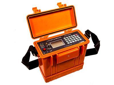
- High Power DC Electrical Measuring System, Type DJF20-1 DFF20-1 high power DC electrical measuring system consists of a rectification power supply (10 kw or 20kw), a 20kw generator, one or multiple (3~5) receivers, stimulators, dummy loads, AB electrodes, AB power lines, reels, measure electrodes and other accessories.
-
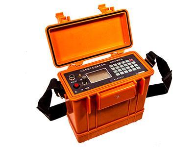
- High Power DC Electrical Measuring System, Type DJF DJF high power DC electrical measuring systems are widely used for mass screening and detailed detection of metal and nonmetal mineral resource survey, high-precision mineral resource survey and the exploration of underground water resources.
-
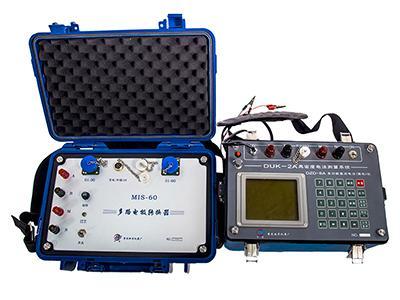
- High Density Electrical Measuring Instrument, Type DUK-2A DUK-2A high density electrical measuring instrument consists of a main measure and control machine (DZD-6A multifunction DC electrical method instrument), DUK-2A multiple electrode convertor (60 or 120 channels), large cables, electrodes, data processing software and related accessories.
-
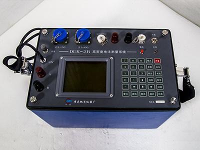
- High Density Electrical Measuring Instrument, Type DUK-2B The instrument can investigate Karst caves, mine-out areas of coal mines, archaeological sites and civil air defense constructions. The instrument can investigate hidden peril of pikes, possibilities of landslide and collapse and other geological disasters.
-
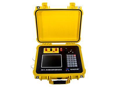
- Ultra High Density Electrical Measuring Instrument With a full wave DC electrical method instrument as main controller, the ultra-high density electrical measuring instrument can be equipped with distributed high density cables and electrodes to conduct measurement of distributed 2D, 3D high density resistivity and induced polarization.
-
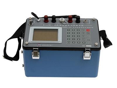
- Multifunction DC Electrical Method Instrument Using parameters from apparent resistivity method and electrical polarizability, multifunction DC electrical method instruments are widely used for exploration of underground water resources, metal and nonmetal mineral resources and investigation of hydrological, engineering and environmental geology.
-
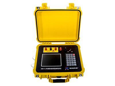
- Full Wave DC Electrical Method Instrument The volume and weight of the instrument are obviously reduced. The main technical indexes and functions are top in the world compared with the similar instruments. The instrument can obtain better raw data in complicated environments than other similar instruments.
-
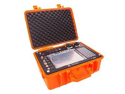
- Geological Seismometer Geological seismometers can used hammering and explosion as artificial seismic sources. Measuring depth ranges from a few to hundreds of meters. Type DZQ6-2A geological seismometers are widely used for engineering geological investigation of hydraulic engineering, electricity, railways, bridges, civil construction and traffic etc.
-
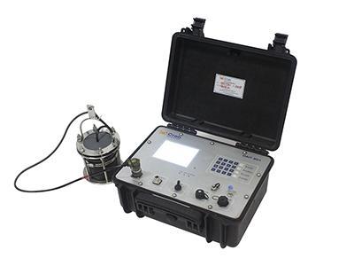
- Seafloor Seismometer
Hydroacoustic measuring instruments are used to activate various hydroacoustic responders and similar/nearby devices.
Power supply: External 100~240V AC; Internal 30~30V DC
-
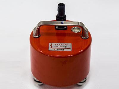
- Geophone Geophones are mainly used for deep seismic observation, advanced prospecting, natural earthquake investigation, measuring and monitoring of micro-vibration of bridges, dams, railways and highways etc.
-
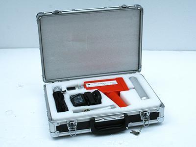
- γ Ray Surveying Instrument
γ ray surveying instrument is a kind of radioactivity surveying instrument controlled by microprocessor chips. γ ray surveying instruments can be used for:
1. Fast γ abnormality survey over a large area
2. Lithological logging of tunnels and trenches ...
-
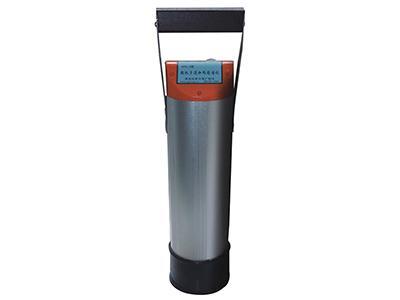
- Handheld Multichannel Gamma Ray Spectrometer Handheld multichannel gamma ray spectrometer is a 1024-channel γ spectrometer capable of both spectral signal collection and field processing. The spectrometer consists of main unit and the scintillation probe. The main unit, a Windows Mobile OS PDA with embedded GPS, communicates with the probe via Bluetooth.
-
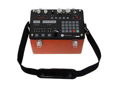
- Winch Controller JCH-3 winch controllers are used together with winches capable of logging boreholes over 1000 meters deep. Automatic speed stabilization, manual speed regulation and automatic overload protection; Automatic depth calculation and error compensation;
-
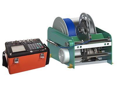
- Three Component Borehole Magnetometer JCX-3 three component borehole magnetometer consists of a ground main unit, borehole probe, elevating equipment (manual or electrical winch), data processing software and related accessories. There is a wide range of winches available (300m-2000m).
-
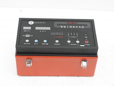
- Intelligent Well Logging System JGS-1B intelligent well logging system consists of main collection unit, winch, cables and all kinds of borehole probes. Pulley and cable connector are optional. There is a wide range of winch options, manual or electrical, from 300m to 3000m.
-
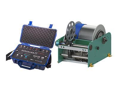
- Portable Well Logging System Portable well logging systems are widely used for shallow and medium depth digital logging of hydrogeology and engineering geology in industries such as hydraulic and hydroelectric projects, railway, highway, municipal administration, electric power, traffic, unban construction survey.
-
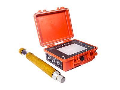
- Borehole Imaging System The borehole imaging system can help accurately determine lithological classification, investigate geological structure, locate soft mudstone interlayers, detect faults, fractures and fractured zones and observe underground water activity etc.
-
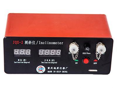
- Portable Digital Inclinometer JQX-2 portable digital inclinometer consists of main ground unit, borehole probe, portable manual winch and related accessories. Portable digital inclinometers are widely used in nonmagnetic and weak magnetic geological borehole vertex and azimuth measurement.
-
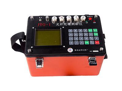
- Fiber Optic Gyro Inclinometer Using high accuracy fiber optic gyro as azimuth measurement sensor, the fiber optic gyro inclinometers can be used to accurately measure borehole inclination and azimuth in environments of severe magnetic interference, e.g. magnetic mineral areas and iron casing pipes etc.
China Geological Equipment Group Co., Ltd. (CGEG) was established in 1987. Our products are suitable for use in the main procedures of geological exploration including ground geophysical exploration, geological drilling, core sampling, well inspection as well as chemical analysis of the minerals. We have products such as drilling rigs, drilling tools, geophysical instruments, analytical instruments and so on. We, CGEG actively expanding our engineering contracting and trading business as well as constructing a foreign trading platform. CGEG has successfully undertaken about 50 national technological innovation projects and this allows us to provide our customers from all over the world with high quality geological exploration equipment.
Inquiry Form
China Geological Equipment Group Co., Ltd.
Add.: 5th Floor, Botai Mansion, No. 221 Wangjing Xiyuan, Beijing 100102
Contact Us:
Tel: +86-510-83769831

 English